Boeing often associated with going on holiday or general consumer flights for the sake of travel, but recently it has shared that with Inexa Control software that flying from country to country isn’t the only thing we should know about. With using augmented reality (AR), it is able to fight wildfires that breakout in forests.
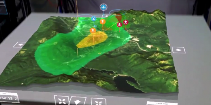
This is the first time that unmanned aerial systems (UAS) are depending on holographic technology to help fight wildfires, with flight operators manipulating and controlling holographic tactical maps of ScanEagles, helicopters, and fire fighters to target where they are most needed.
Teddy Trobridge, Software Engineer, Insitu, explained what Boeing has been doing, and how exactly it has been useful: “What we’ve done is taken the HoloLens, which is a mixed reality headset, and we’ve taken that critical map display and put it into three dimensions. Just drag the aircraft on the map and the aircraft knows how to fly its pointed sensor automatically. Now, four or five people can get on the HoloLens and be looking at that same map in three dimensions inside of a room. Working in a 3D space becomes almost in a Hollywood movie.”
Greer Carper, Product Manager, Insitu, rounded up and described this new use of the HoloLens pretty concisely, giving reasons for the practical use, saying: “Control with the HoloLens today is like a real time strategy game, where you can see all the manned aircraft, all the unmanned aircraft, the fire teams on the ground. For a fire chief, 3D becomes a valuable tool to get better contextualisation of what’s going on.”
It’s hoped that this technology can control many different aircraft and take on multiple missions “from fighting wildfires to observing crops”.
For more on the latest news, updates, and features in the world of VR, make sure to check back with VRFocus.


